Posted on July 2, 2019
Author Anita Goodan, WKVI
The National Weather Service has issued a heat advisory today from 1 p.m. to 7 p.m. CT.
Starke County EMA Director J. Nier urges residents to limit time outside today. Seek shelter in an air conditioned area or find shade to rest. Nier also advises residents to stay hydrated by drinking a lot of water. Stay away from pop or alcohol.
Heat exhaustion can occur quickly. The symptoms of heat exhaustion include feeling faint or dizzy, excessive sweating, clammy skin, nausea or vomiting, rapid weak pulse, and muscle cramps.
Heat stroke symptoms include a throbbing headache, no sweating, red dry skin, nausea or vomiting, and loss of consciousness.
Seek medical attention if either medical condition occurs.
Check on elderly neighbors and make sure small children are safe.
Showing posts with label National Weather Service. Show all posts
Tuesday, July 2, 2019
Monday, March 19, 2018
State Wide Test of Emergency Alert System to be Held Tuesday Morning
Posted on March 19, 2018
Author Jacque Ryan, WKVI
As a part of Severe Weather Preparedness Week, which runs from March 18th through the 24th, Indiana broadcast stations will participate in a statewide tornado drill on Tuesday, March 20th.
The National Weather Service test of the statewide Emergency Alert System will be issued for 15 minutes at 9:15 a.m. CT/10:15 a.m. ET tomorrow morning.
The tornado test drill is being conducted to ensure that the statewide Indiana Emergency Alert System network is operating properly and that it will be ready to respond in the event of a tornado warning.
Indiana Broadcasters Association Executive Director Dave Arland commented that all Hoosiers know how erratic Indiana weather can be so officials just want to make sure their systems are firing on all cylinders in case Mother Nature shows us her worst.
According to Arland, the IBA has been participating in this drill for more than three decades and broadcasters remain committed to doing all they can to keep Hoosiers safe at times when they are often most vulnerable.
In the event of severe or inclement weather, the test will be rescheduled and held on Wednesday, March 21st.
Author Jacque Ryan, WKVI
As a part of Severe Weather Preparedness Week, which runs from March 18th through the 24th, Indiana broadcast stations will participate in a statewide tornado drill on Tuesday, March 20th.
The National Weather Service test of the statewide Emergency Alert System will be issued for 15 minutes at 9:15 a.m. CT/10:15 a.m. ET tomorrow morning.
The tornado test drill is being conducted to ensure that the statewide Indiana Emergency Alert System network is operating properly and that it will be ready to respond in the event of a tornado warning.
Indiana Broadcasters Association Executive Director Dave Arland commented that all Hoosiers know how erratic Indiana weather can be so officials just want to make sure their systems are firing on all cylinders in case Mother Nature shows us her worst.
According to Arland, the IBA has been participating in this drill for more than three decades and broadcasters remain committed to doing all they can to keep Hoosiers safe at times when they are often most vulnerable.
In the event of severe or inclement weather, the test will be rescheduled and held on Wednesday, March 21st.
Thursday, June 22, 2017
Lightning Safety Week Raises Awareness of Weather Dangers
Posted on June 22, 2017
Author WKVI
The Indiana Department of Homeland Security and the National Weather Service have partnered to celebrate Lightning Safety Awareness Week in the state, June 18-24. The week is designed to have Hoosiers have a better understanding of the dangers of lightning.
If thunder is heard and no lightning is observed, the chance of one being struck by lightning is still there.
One can reduce the chance of being struck by lightning by staying away from water, high grounds, open areas, metal objects and electrical wire during a storm.
Author WKVI
The Indiana Department of Homeland Security and the National Weather Service have partnered to celebrate Lightning Safety Awareness Week in the state, June 18-24. The week is designed to have Hoosiers have a better understanding of the dangers of lightning.
If thunder is heard and no lightning is observed, the chance of one being struck by lightning is still there.
One can reduce the chance of being struck by lightning by staying away from water, high grounds, open areas, metal objects and electrical wire during a storm.
Wednesday, February 1, 2017
Storm Spotter Class Scheduled in Marshall County
Posted on February 1, 2017
Author Mary Perren, WKVI
The National Weather Service, Marshall County Emergency Management Agency and Marshall County SKYWARN group are hosting a storm spotter training class.
It will cover the basics of thunderstorm development, fundamentals of storm structure, identifying potential severe weather features, information to report and how to report it and basic severe weather safety.
Participants are encouraged to complete the MetED Online Spotter Training prior to attending the class. It can be found online at https://www.meted.ucar.edu/training_course.php?id=23.
The SKYWARN concept was developed in the early 1970s to promote a cooperative effort between the National Weather Service and local communities. The effort focuses on individual, community-based storm spotters who report on wind gusts, hail size, rainfall and cloud formations that could signal a developing tornado.
The training is free and open to the public. It will take place Thursday, Feb. 23 at 6 p.m. EST in room 203 of the Marshall County Building at 112 W. Jefferson St. in Plymouth. Check-in will begin at 5:30 p.m.
Online registration is encouraged and can be done by visiting http://marshallINSpotter.eventzilla.net. Registration can also be done by calling 574-936-3740 or 574-834-1104.
Author Mary Perren, WKVI
The National Weather Service, Marshall County Emergency Management Agency and Marshall County SKYWARN group are hosting a storm spotter training class.
It will cover the basics of thunderstorm development, fundamentals of storm structure, identifying potential severe weather features, information to report and how to report it and basic severe weather safety.
Participants are encouraged to complete the MetED Online Spotter Training prior to attending the class. It can be found online at https://www.meted.ucar.edu/training_course.php?id=23.
The SKYWARN concept was developed in the early 1970s to promote a cooperative effort between the National Weather Service and local communities. The effort focuses on individual, community-based storm spotters who report on wind gusts, hail size, rainfall and cloud formations that could signal a developing tornado.
The training is free and open to the public. It will take place Thursday, Feb. 23 at 6 p.m. EST in room 203 of the Marshall County Building at 112 W. Jefferson St. in Plymouth. Check-in will begin at 5:30 p.m.
Online registration is encouraged and can be done by visiting http://marshallINSpotter.eventzilla.net. Registration can also be done by calling 574-936-3740 or 574-834-1104.
Tuesday, March 22, 2016
3/22/2016 Statewide Tornado Drill Set for Today
AuthorMichael Gallenberger, WKVI
At 10:15 a.m. and 7:35 p.m. EDT, the National Weather Service will test its tornado warning procedures, which will activate Emergency Alert System tests on radio and television stations, as well as tornado sirens in many communities across the state.
The Indiana Department of Homeland Security says there are a few steps you can practice to make sure you’re ready for a tornado. If you’re at work or school, check to see if there is a severe weather plan and know where the designated safety area is. Otherwise, move to an interior area on the lowest level of the building, away from windows.
If you’re at home, go to the basement or lowest level, and move away from exterior windows and doors. Those who live in mobile homes or similar buildings should plan ahead to find a safe and sturdy structure to go to, in the event of a tornado. The IDHS says mobile homes are not safe shelters during a tornado, since they often can’t withstand the wind speed and pressure.
It’s also important to be able to receive notice of severe weather. One of the best ways to do that is to have an all-hazards weather radio in your home near your sleeping area. Also, consider making sure you’re able to receive emergency notifications on your cell phone.
Today’s statewide tornado drill is part of Severe Weather Preparedness Week.
Tuesday, March 15, 2016
Prepare for Spring Floods During Flood Safety Awareness Week
AuthorMichael Gallenberger, WKVI

The Indiana Department of Homeland Security is urging residents this week to plan ahead for potential floods, in recognition of Flood Safety Awareness Week.
They say residents can prepare for flooding by putting together a disaster preparedness kit containing enough essential items to last your family for at least three days. Families should also develop an escape plan with multiple ways out, in case some of the roads are flooded. A communications plan should also be created, including an out-of-state contact and places where family members can meet should they become separated.
The IDHS also says some simple yard work can go a long way to reduce the effects of flooding around your home. They say when water levels are low, clear any debris from waterways, ditches and culverts. Additionally, if you see any large obstructions in rivers or creeks, contact local emergency management officials. If flooding does occur, clear debris from storm drains using a rake or shovel to avoid contact with flood water.
Some other precautions include making sure all sump pumps are working, clearing debris out of gutters and drain spouts, and keeping any important documents in a safe, waterproof file. Check local weather and river forecasts, since water levels can change rapidly. If there’s a chance that rising water may cut off access to and from your home, consider evacuating ahead of time.
However, the National Weather Service says that most flood-related deaths happen while driving.
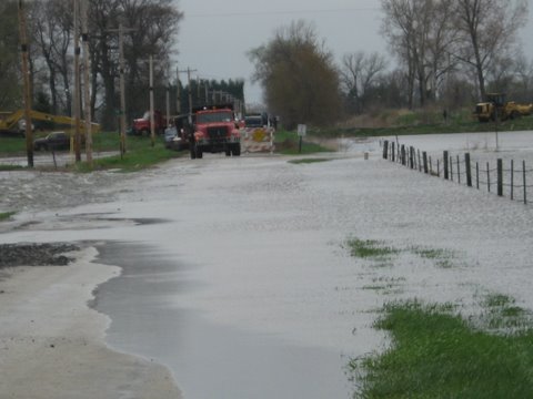
The IDHS reminds drivers not to attempt to cross a flooded road, since water can conceal dips or wash away the entire road surface. They say that just a few inches of moving water can carry away most vehicles, including trucks and SUVs.
Additionally, since floods can lead to expensive damage, the IDHS recommends that homeowners consider purchasing flood insurance and keep a thorough documentation of their belongings.
For more flood safety tips, visit GetPrepared.in.gov.
Thursday, March 6, 2014
The US National Weather Service Northern Indiana Is Looking For Volunteers
Attention Weather Enthusiasts: it's time for March Madness...CoCoRaHS edition! It's a race to see which state can sign up the most new volunteers before the end of the month!
We need your help measuring precipitation and snowfall across the region. For more local information see http://www.crh.noaa.gov/iwx/?n=iwxcocorahs. To sign up to become a CoCoRaHS observer see www.cocorahs.org.
Saturday, February 22, 2014
Latest River Forecast Information & Flood Warnings
From the US National Weather Service Northern Indiana:
Ice jams and minor river flooding continue across portions of the area. Ice jams can and have happened without much notice, making for difficult flooding forecasts. Sometimes, these jams occur away from a river gauge which makes it hard for us to know what's actually occurring. Much like the situation along the Little River in Huntington that caused evacuations yesterday. You can see the latest river forecast info and flood warnings at http://water.weather.gov/ahps2/index.php?wfo=iwx
Reports or pictures of flooding and ice jams are always appreciated and can be posted here!
Subscribe to:
Posts (Atom)